Fifty-five thousand hectares of water that would have silted up centuries ago if the Republic had not spent four hundred years preventing it. The lagoon is a public works project that happens to look like a landscape.
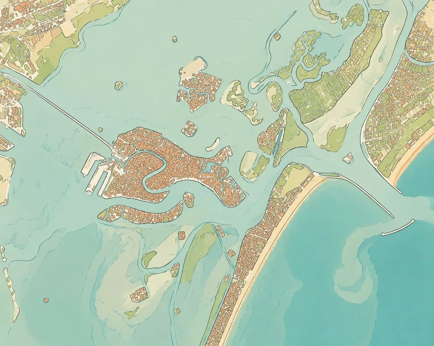
Seen from above, the lagoon shows its workings: the channels, the built-up islands, the salt marshes and sandbanks, the movements of the water, and the mark left on it all by human hands.
A lagoon is an unstable condition. It lives between two exactly opposite threats: the
rivers that fill it with silt, and the sea that empties it by carrying its bed away. Left to
itself it becomes marsh, then meadow, then dry land, which is what happened to every other
lagoon on the Adriatic. If the Venetian one is still here, it is because an administration
looked after it without a break for eight centuries.
The work was enormous and it is almost invisible. Between the fourteenth and the
seventeenth century the Republic diverted its rivers one by one, the Brenta to the south,
the Sile and the Piave to the north, so that they discharged into the sea instead of the
basin. It forbade clearing the banks, drove piles to hold the channels, dredged, scoured and
surveyed. A dedicated magistracy, the Savi ed Esecutori alle Acque, had authority over
anything touching the water, and its rulings overrode those of landowners. Then, in the
eighteenth century, came the greatest work of all: the murazzi, a wall of Istrian
blocks twenty kilometres long, laid along the barrier islands to stop the sea. It was
finished in 1782. Fifteen years later the Republic was gone.
What you see from a vaporetto therefore has to be learned. The wide flat stretches of
short grass that break the surface at low tide are the barene, natural salt
marshes and the real lungs of the system: they take up the tides and feed the birds. The
velme, lower down, appear only at the lowest waters. Between them wind the
ghebi, tiny creeks through which the water comes and goes. And everywhere, planted
in threes and fives, stand the bricole, bundles of oak piles marking the navigable
channels. You travel the lagoon as you drive a road: outside the channel there is forty
centimetres of water and then mud, and the propeller goes into it.
Nor is the history of this water Venice's alone. In the seventh century the seat of the duchy was at Eraclea on the northern shore, with
Torcello as its great port and its bishopric; in the eighth the duchy moved to Malamocco on
the Lido; it settled at the Rialto only in 810, after a Frankish attack. Each move followed
the same logic: further from the mainland, closer to the middle of the water. The northern
islands then emptied slowly, as the rivers brought their silt, malaria took hold and the
port shifted, Torcello had as many as twenty thousand inhabitants and now has about ten.
That emptiness turned the lagoon into a reserve for functions the city did not want
indoors. The glassmakers went out there because of fire; the mad and the infectious because
of fear; then the powder magazines, the quarantine stations, the forts, the cemeteries, the
convents. Things were also grown out there: Sant'Erasmo and the Vignole fed Venice
vegetables for centuries and still do, a little. And fishing never stopped, at Burano, at
Pellestrina, at Chioggia, and in the valli da pesca, embanked ponds where fish have
been raised since the Middle Ages.
Today the balance has shifted again. Dredged shipping channels, sinking ground and rising
seas mean that the sea the Republic walled out now comes in faster than it goes out. The
modern answer is called MOSE: seventy-eight hinged gates lying on the floor of the three
inlets, which rise when the forecast tide passes a set level. It is the same reasoning as
the murazzi, two and a half centuries later, in steel instead of stone.
Ten places, from the north of the lagoon to the south
La Serenissimap carries 71 of them, each with its own note.
01Torcello
north of the lagoon · about ten inhabitants
The first great port of the lagoon, a bishopric when Venice was nothing, and the clearestpicture of what silt and malaria can do: twenty thousand people, a bishop and a port became a field, a canal and two of the finest buildings in the Veneto. Come early or late; between the boatloads it is silent.
02Mazzorbo
north of the lagoon, joined to Burano by a wooden bridge
Once Maiurbium, the greater town, and now the quiet one: vineyards, allotments, a Gothic church and the oldest bell in the lagoon, cast in 1318. The walled vineyard here grows Dorona, a native golden grape that had nearly disappeared.
03Burano
north of the lagoon · lace and painted houses
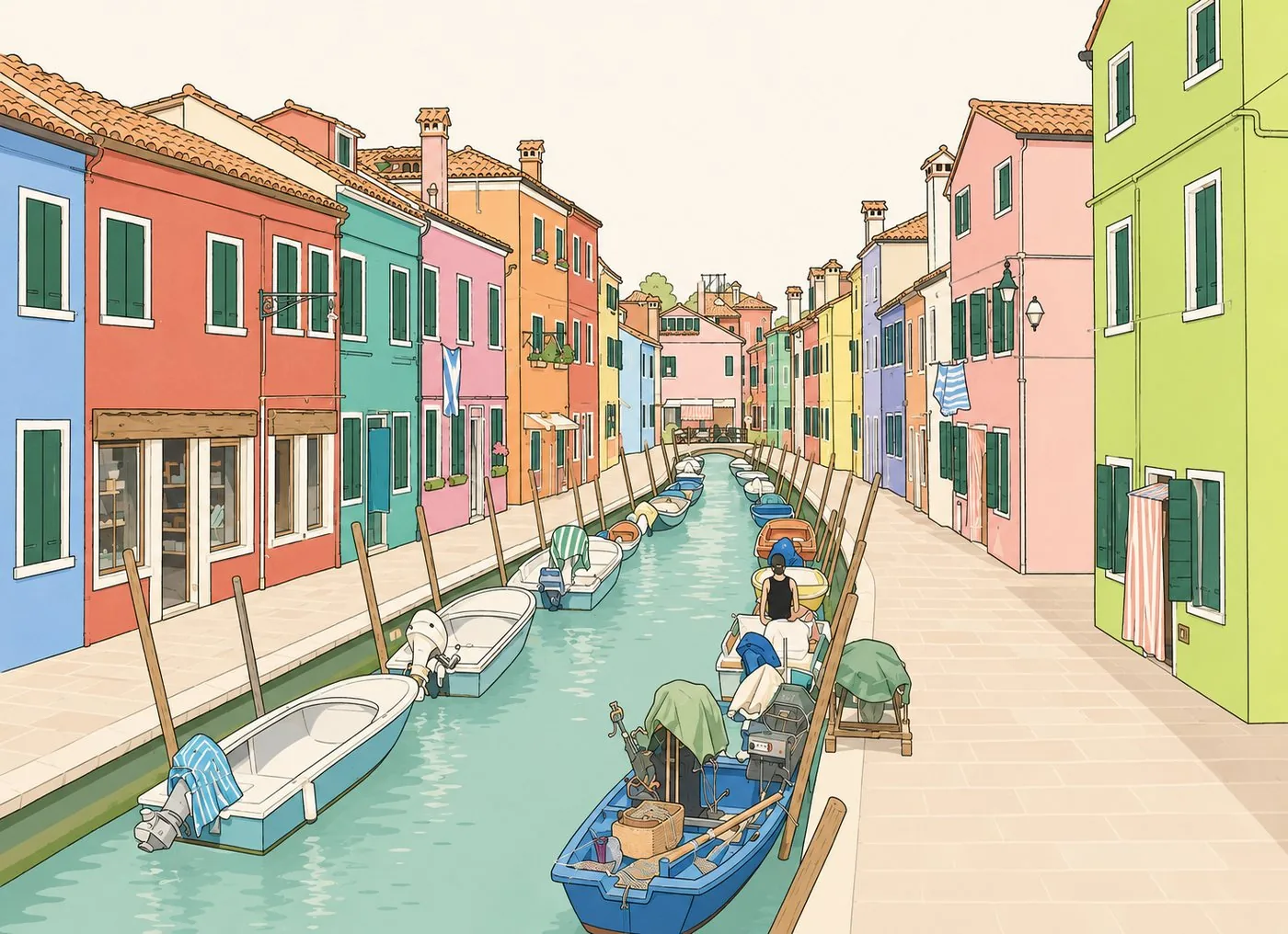
The colours are not folklore: fishermen painted their houses so as to pick them out from the water in fog, and the shades are still subject to approval. The island's other trade was needle lace, a craft so slow that a single collar could take years, the school reopened in 1872 to save it, and the museum shows the difference between hand and machine.
No two neighbours share a colour, and that is the whole point: in fog, a fisherman coming home found his own front by its shade. The shades are still subject to approval.
04San Francesco del Deserto
north of the lagoon · a Franciscan community, visits by arrangement
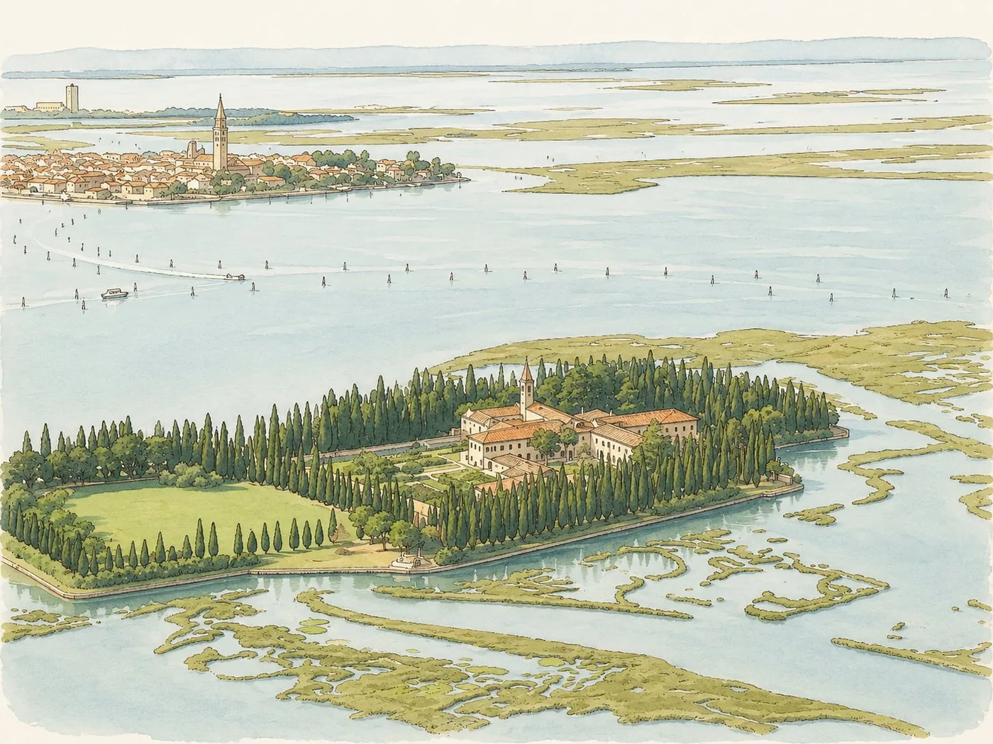
Four thousand cypresses, a cloister, a handful of friars, and no shop of any kind. Tradition puts Francis of Assisi here on his way back from Egypt in 1220; what is certain is that the community has held the island almost continuously since. You need a private boat from Burano, and it is worth the trouble.
Four thousand cypresses around a cloister, and Burano on the horizon with its leaning campanile. Between the two, the barene, the salt marshes that breathe with the tide.
05Murano
north of Venice · glass since 1291
The furnaces were moved here in 1291, officially because of fire risk in a city of timber, and conveniently because it put the trade secrets on an island the state could watch. Masters were given privileges and forbidden to leave. Go for the glass museum and the apse of Santi Maria e Donato rather than the souvenir windows.
06Sant'Erasmo
east of the lagoon · the market garden
Nearly as large as Venice itself and almost entirely under vegetables, this is where the city's greens came from, and the violet artichoke grown here still has its own season and its own price. No monuments to speak of: come for flat horizons, dirt tracks and a bicycle.
07San Lazzaro degli Armeni
off the Lido · Armenian monastery, guided visits daily
A former leper island granted in 1717 to an Armenian abbot fleeing the Ottomans, and continuously a monastery ever since, through Napoleon, who suppressed everything else and spared this because he classed it as an academy. The library holds thousands of Armenian manuscripts. Byron came here to learn the language.
08Malamocco
the Lido · capital of the lagoon before Venice
For some seventy years this was the seat of the duchy, until a Frankish fleet forced the move to the Rialto in 810. The old town was later lost and rebuilt further in; what you walk through now is a small, complete Venetian village, canal, campo, loggia, town hall, five minutes from a beach.
09Pellestrina
the southern lido · eleven kilometres long, a few hundred metres wide
A thread of land with the sea on one side and the lagoon on the other, four fishing villages, and along the whole seaward edge the murazzi, the eighteenth-century sea wall, still doing its job. Walk on top of it: on your left the Adriatic, on your right the boats and the drying nets.
10Chioggia
southern end of the lagoon · about 50,000 inhabitants
Venice's plan, at half scale and with cars: one long straight corso, canals either side, calli running off at right angles, and the largest fishing fleet on the Adriatic tied up at the end of it. The war fought here in 1379–1380 nearly finished the Republic. The morning fish market is the real reason to come.
Common questions
How big is the Venetian lagoon?
About 550 square kilometres, some 55,000 hectares, which makes it the largest lagoon in the Mediterranean. Published figures vary with what is counted as lagoon: open water, mudflats, salt marsh and fish farms are not always included together. Venice and its lagoon have been a UNESCO World Heritage site since 1987.
How many islands are inhabited in the lagoon?
Ten, by the latest ISTAT census. The Lido shore holds 17,848 residents, Murano 4,968, Pellestrina 4,471, Burano 3,267, Sant'Erasmo 771, Mazzorbo 364, the Vignole 69, Torcello 25, Mazzorbetto 10 and San Clemente 1. Dozens of others are empty, some of them abandoned monasteries, quarantine stations or gunpowder magazines.
Why has the lagoon not silted up?
Because the Republic spent four centuries preventing it. Rivers carry sediment, and a lagoon left alone fills in and becomes marsh, then land. Venice diverted the Brenta, the Sile and the Piave away from the basin, and policed the boundary with boundary stones. The lagoon is a public work that took on the look of a landscape.